
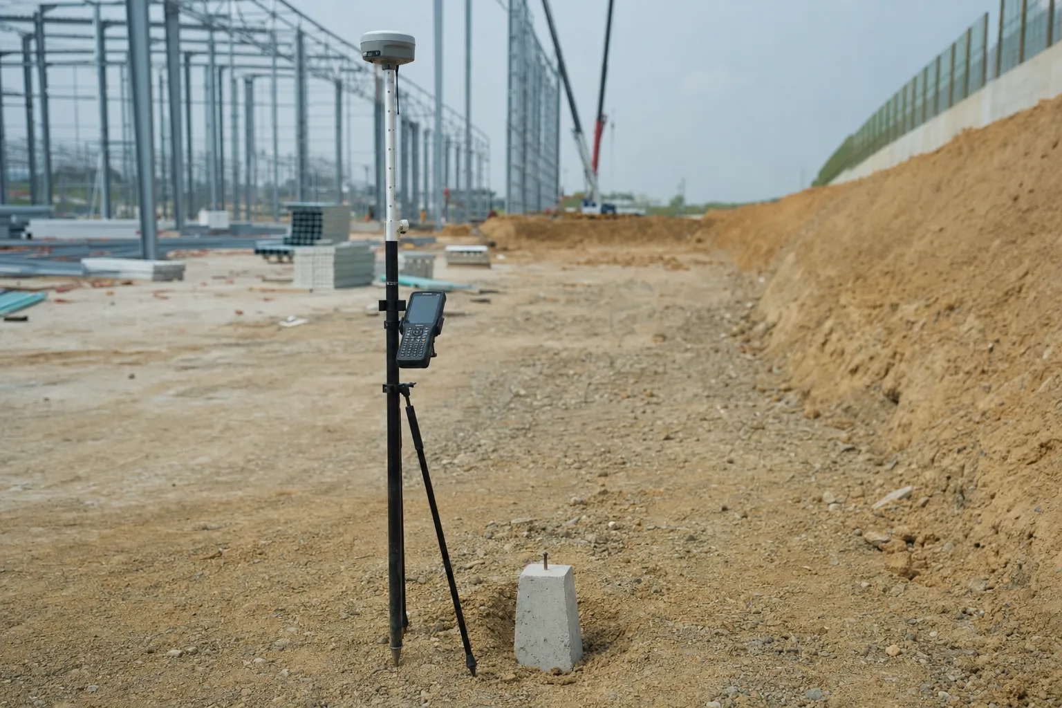
RTK GPS gives a surveyor a position in seconds, and a green "fixed" indicator that looks like a guarantee. On GPS and GNSS surveys, that indicator reports one specific thing, and reading it as a finished accuracy check is a common cause of points that do not match.
Quick Answer
A fixed RTK solution means the receiver has resolved its carrier-phase integer ambiguities to a consistent solution. It does not confirm the base coordinate, the antenna height, the coordinate system in use, or that nearby surfaces did not reflect the signal. Check a known control point before and after the work, and confirm the base, height and coordinate system at the start of each session.
The terms GPS and GNSS are often used as if they meant the same thing. Our article on GNSS vs GPS explains the difference. This article uses RTK GPS in its everyday sense: real-time kinematic positioning with a survey receiver.
What the fix indicator on RTK GPS reports
The fix status reports the outcome of ambiguity resolution, one step inside the receiver's calculation, and not the quality of the final coordinate.
To reach survey-grade positions, the receiver has to work out how many whole wavelengths of the satellite signal lie between it and each satellite. Those whole numbers are the integer ambiguities. When the receiver resolves them to a single consistent solution, it reports "fixed". When it cannot, it reports "float". A fix is the necessary first condition for a good RTK position. It is not the last one.
What a fix does not check
The receiver calculates its position relative to a base station or correction network. If the base coordinate is wrong, every rover point moves with it, and the rover stays fixed. If the antenna height was entered wrongly, every height is out by the same amount, and the rover stays fixed. If the controller is set to a different coordinate system from the design, the points are calculated correctly on the wrong system, and the rover stays fixed.
Key point
A fixed RTK GPS solution means the receiver solved its own calculation. It does not mean the base, height and coordinate system were right.
Points that do not match the client's?
Send us the base details and a sample of points. We will check where they differ.
Ask us to check the pointsSignals near hard surfaces
Signals reflecting off nearby hard surfaces, or partly blocked by them, can degrade an observation without the receiver dropping out of a fixed solution or raising a warning.
The reflection is called multipath. On a construction site or a mine, the surfaces that cause it are everywhere: buildings, steel, embankments, stockpiles, highwalls and parked vehicles. The risk increases close to those surfaces and varies with the receiver and antenna. It cannot be assumed absent because the fix indicator is green. Where a point must be observed close to a structure, observe it more than once, at different times, and compare the results.
Checks that still matter on site
A short set of routine checks catches most of the problems that a fix indicator cannot, and each one takes minutes rather than hours.
| Check | What it catches |
|---|---|
| Known control point at the start | A wrong base coordinate or coordinate system |
| Antenna height confirmed each setup | A height error carried into every point |
| Coordinate system confirmed in the controller | Correct points on the wrong system |
| Repeat observation near structures | Multipath that did not break the fix |
| Known control point at the end | Anything that changed during the session |
Record each check with the time and the result. On setting out, that record is the evidence that the points were right when they were placed, as covered in our article on setting out survey readiness. Observation method matters too. Static observation over longer periods is generally used for control, and RTK GPS for detail pick-up and setting out on topographical surveys and civil construction surveys. The South African Geomatics Council registers geomatics practitioners in South Africa and is a useful reference for the professional standards survey work is measured against.
Key point
Check a known control point before and after every RTK GPS session. It is the one check that tests the whole chain, not only the receiver.
Need control your RTK work can rely on?
Tell us the site and the coordinate system. We will price the control network.
Get a GNSS survey quoteWhere survey cannot help you
Good field checks make RTK results dependable, but some problems cannot be corrected from the rover.
A check on a known point shows whether the session agrees with that point. It cannot prove the known point itself is right, which is why control needs its own verification. Points already set out from a wrong base cannot be corrected without being found and re-set. Satellite positioning cannot work without a view of the sky, so it cannot be used inside buildings or underground workings, where control is carried in by other methods, as on underground mining surveys.
When two parties' points disagree, the fastest route to an answer is usually to compare the basis of each set before re-observing anything. Which base or correction source was used? Which coordinate system and height datum? Which control points were checked, and when? Two sets of RTK GPS points that were each observed carefully can still disagree because they were tied to different control. Finding that difference first saves a return visit, and it shows which set of points should be corrected.
Two sets of points in dispute?
An independent check can establish which control each set was tied to.
See survey auditsLet's Build With Accuracy.
GNSS control and RTK work checked against known points at the start and end of every session.
Request a Quote No obligation — we reply within one business day.