Service

Ground Penetrating Radar & Utility Detection

Locating what is already buried — cables, pipes, services and voids — before the first blade breaks ground.

What it is

Ground Penetrating Radar & Utility Detection — engineered for accuracy.

Every excavation carries the same risk: the drawing says the cable is three metres left of where it actually is. Municipal as-built records are often decades old, services get relocated without record, and the first indication of an error is a severed fibre trunk or a ruptured water main.

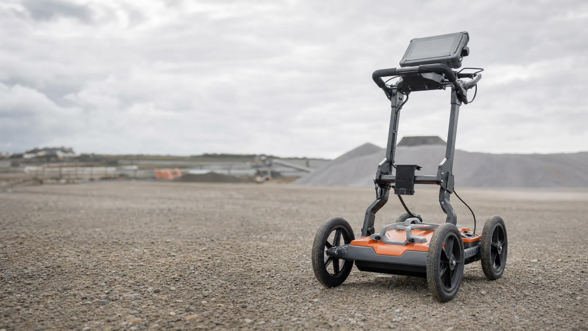
Ground penetrating radar sends pulses of electromagnetic energy into the ground and reads what comes back. Changes in material density — a pipe, a cable duct, a void, a disturbed backfill trench — reflect that energy differently to the surrounding soil.

Survey House Group delivers detection as a survey discipline rather than a standalone scanning service. Findings are positioned against project control and issued as coordinated data, so what we find integrates directly with your design and your as-built record.

Where it's used

Typical applications

  • Pre-excavation utility clearance for trenching and civils
  • Fibre and telecommunications route clearance
  • Cable, pipe and duct locating on brownfield sites
  • Void, sinkhole and subsidence detection
  • Concrete scanning — rebar, post-tension cables, slab thickness
  • Verification of as-built service records before design
What you receive

Typical deliverables

  • Coordinated utility plans in CAD or GIS format
  • Depth and position estimates with stated confidence
  • Site markout with survey-referenced positions
  • Detection reports noting ground conditions and limitations
How it's done

Method, verification and limitations

GPR transmits electromagnetic pulses and records reflections from interfaces where material properties change. Electromagnetic locating is used alongside it for conductive services, which it detects more reliably.

Limitations are material and we state them plainly. Penetration depth depends heavily on ground conditions — dry sand and gravel allow substantially deeper returns than wet clay, which attenuates the signal severely. Higher-frequency antennas resolve smaller targets but reach less deep.

Detection is high-quality guidance for careful excavation. It is not a guarantee of a clear dig, and no competent contractor will offer one. Where further verification is required, it should be planned through the responsible site team using methods appropriate to the services, ground conditions and site procedures.
Before you enquire

Information needed for a quotation

  • Site location and extent
  • Ground conditions and surface type
  • Known or suspected services
  • Depth of interest
  • Whether coordinated data or site markout is required
  • Access constraints and permit requirements
Questions

Ground Penetrating Radar & Utility Detection — frequently asked questions

How deep can ground penetrating radar detect?

It depends on ground conditions and antenna frequency, not on the equipment alone. Dry granular soils allow considerably deeper penetration than wet clay, which attenuates the signal sharply. Any quotation offering a fixed depth capability without asking about your ground conditions should be treated with caution.

Can GPR find plastic pipes?

GPR can detect some plastic pipes under suitable conditions. Electromagnetic tracing needs a suitable signal path: a tracer wire or an inserted sonde may allow a non-metallic route to be located where access and site conditions permit. GPR responds to the contrast between the pipe and the surrounding soil, so detection is not guaranteed: it depends on target size and depth, the degree of contrast, antenna frequency and ground conditions. An empty small-diameter pipe in wet clay may return nothing usable. Detection capability should be assessed against the specific site rather than assumed.

Is GPR alone enough to clear a site for excavation?

No single method should be relied on alone. Good practice combines electromagnetic locating for conductive services, GPR for non-conductive and unknown targets, and review of available records — followed by careful excavation. Detection reduces risk substantially; it does not eliminate it.

What is the difference between utility locating and a utility survey?

Locating marks positions on the ground for immediate use. A survey positions those detections against project control and delivers them as coordinated data that integrates with design and as-built records. We provide the second; the markout is a by-product.

Can GPR scan reinforced concrete?

Yes, using higher-frequency antennas to locate rebar, post-tension cables and conduits before coring or cutting. Dense reinforcement mats can mask targets beneath them, so scans are read alongside structural drawings where available.

Proof

Recent applications

Project references for detection work are being compiled. Equipment specification, method statements and deliverable examples are available on request.

Planning your appointment

Project scope and practical considerations

Planning a utility investigation

Identify the proposed works, survey extent, known services and areas where records are incomplete. Supply available utility plans, previous investigations and access constraints. The purpose of the investigation should guide both the field work and the reporting requirements.

State whether the output is needed for design coordination, a survey-referenced record or planning further verification. Detection information should be passed into the project’s excavation and permit processes rather than treated as a standalone permission to dig.

Interpreting detected and undetected features

A reported feature is an interpretation of the observations and supporting evidence. Detection confidence and depth limitations vary with conditions and target characteristics. An area with no interpreted target is not proof that no service exists there.

Reports should identify the surveyed extent, inaccessible areas, applicable limitations and locations requiring further investigation. Keep the detected record distinguishable from positions copied from plans.

Coordinated outputs and follow-up work

Agree how detected features will be referenced to the site survey and represented in the deliverable. Where excavation or other verification is required, the responsible site team must plan a suitable method. Concrete scanning and buried-utility detection also require different scope and equipment considerations; specify which task is required.

Get started

Let's Build With Accuracy.

Tell us about your project and we'll respond within one business day.